
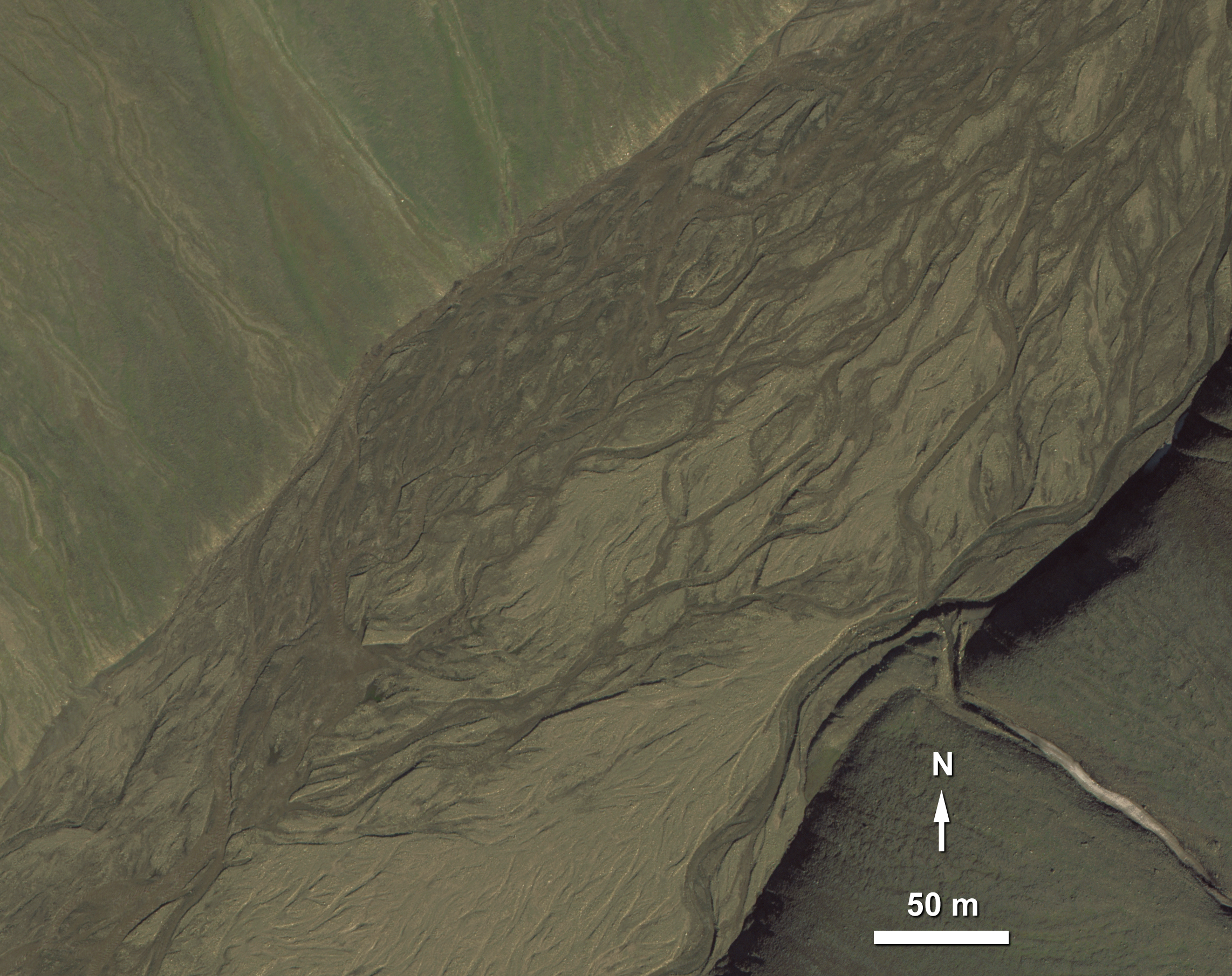
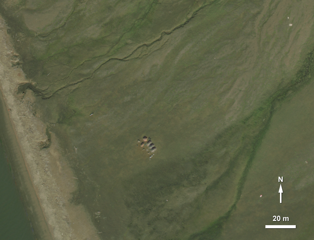
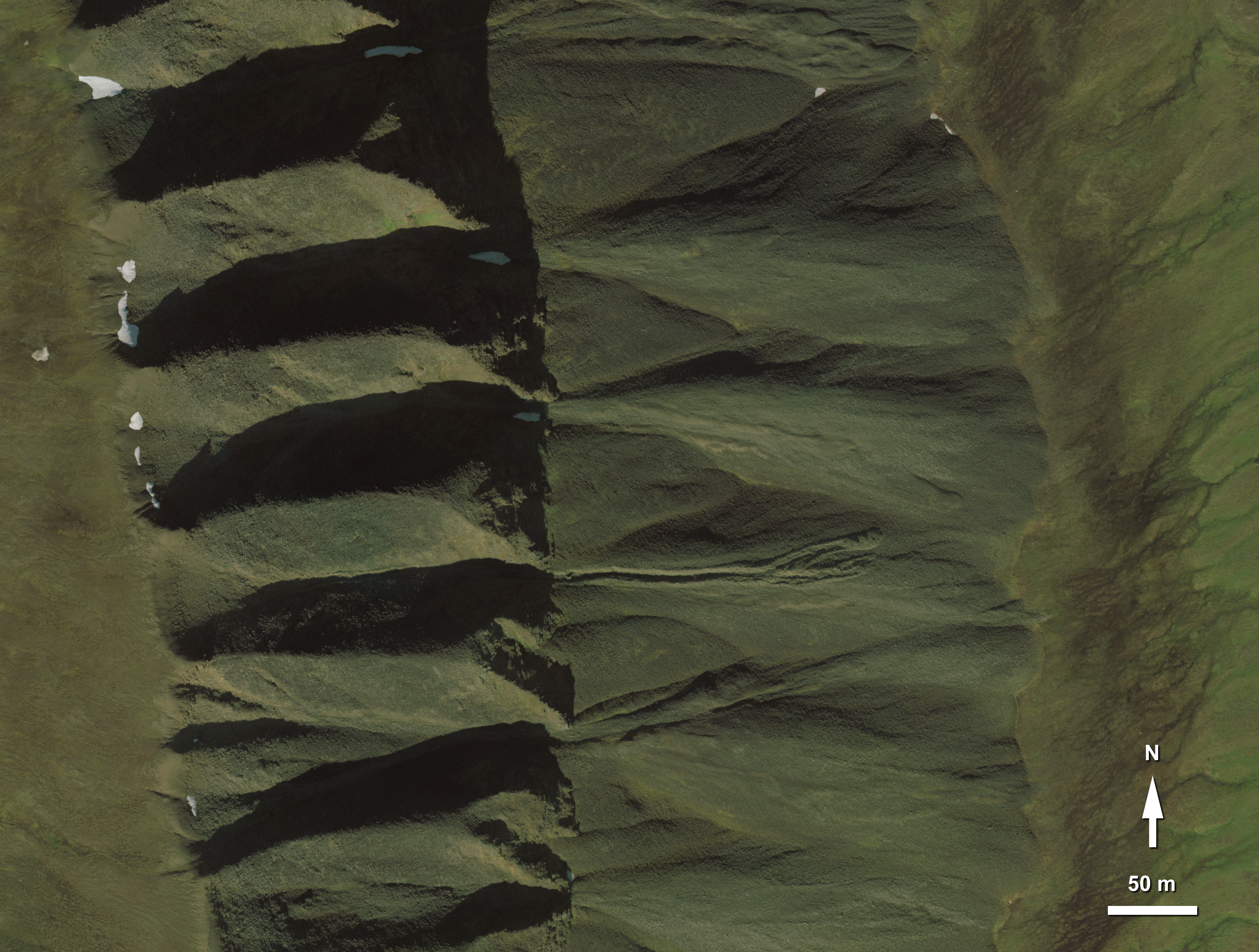
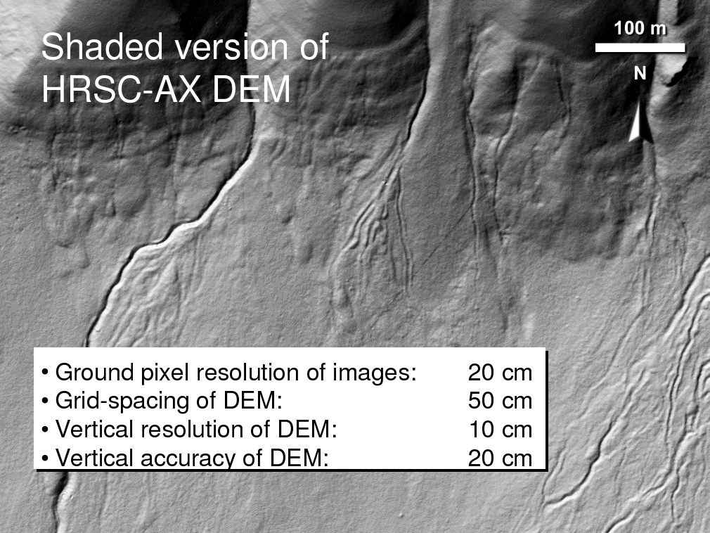
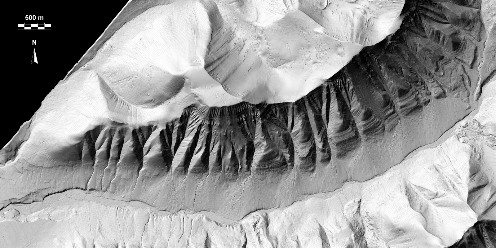
An airborne version of the HRSC camera was used for the acquisition of stereo and color images. HRSC (High Resolution Stereo Camera) (Fig. 1) is a multi-sensor push broom instrument with 9 CCD line sensors mounted in parallel. It simultaneously obtains high-resolution stereo, multicolor and multi-phase images. Based on 5 stereo channels, which provide 5 different views of the ground, digital photogrammetric techniques are applied to reconstruct the topography. The four 4 color channels are used to make true orthophotos in color and false-color. HRSC is in orbit around Mars since January 2004 (Jaumann et al., 2007). As for November 2009, high-quality DEM and corresponding orthoimages are available for more than 30% of the Martian surface. The particular value of HRSC is the stereo capability, which allows to systematically produce high-resolution Digital Elevation Models (DEM) with grid sizes between 50 and 100 m (Wewel et al., 2000; Scholten and Gwinner, 2004; Scholten et al., 2005; Gwinner et al., 2005, 2009a,b). Since 1997, different airborne versions of HRSC have been developed. The principles of HRSC-AX data processing are described by Gwinner et al. (2006). The orientation data of the camera is reconstructed from a GPS/INS (Inertial Navigation System). HRSC-AX has been applied in diverse technical and scientific applications (e.g., Gwinner et al., 1999, 2000; Hauber et al., 2000; Otto et al., 2007) and was also successfully used to investigate rock glacier activity (Roer and Nyenhuis, 2007). The flight campaign in July/August 2008 covered a total of seven regions in Svalbard: (i) Longyearbyen and the surroundings of Adventfjorden, (ii) large parts of Adventdalen, (iii) large parts of the Brøggerhalvøya (halvøya = peninsula) in western Spitsbergen, (iv) the Bockfjorden area in northern Spitsbergen, (v) the northeastern shore of the Palanderbukta and the margin of the adjacent ice cap in Nordaustlandet, (vi) an area on Prins Karls Forland, and (vii) the area of the abandoned Russian mining settlement of Pyramiden together with the nearby Ebbedalen. The landforms discussed in this study are located on the Brøgger peninsula and in Adventdalen and its vicinity. Examples of true-color and false-color HRSC-AX images of permafrost landforms in Svalbard are shown in Fig. 2-6 and Fig. 7, respectively. Examples of DEM are shown in Fig. 8 and 9.


References:
Gwinner, K., Hauber, E., Hoffmann, H., Scholten, F., Jaumann, R., Neukum, G., Coltelli, M., and Puglisi, G., 1999, The HRSC-A experiment on high resolution imaging and DEM generation at the Aeolian Islands: Proceedings of the 13th International Conference on Applied Geologic Remote Sensing, 0103 March, Vancouver, Canada, ERIM International, Ann Arbor, Michigan, v. I, p. 560569.
Gwinner, K., Hauber, E., Jaumann, R., and Neukum, G., 2000, High-resolution, digital photogrammetric mapping: A tool for Earth science: EOS Transactions, American Geophysical Union, v. 81(44), 513520.
Gwinner, K., Scholten, F., Spiegel, M., Schmidt, R., Giese, B., Oberst, J., Jaumann, R., Neukum, G., and the HRSC Co-Investigator Team, 2005, Hochauflösende Digitale Geländemodelle auf der Grundlage von Mars Express HRSC-Daten: Photogrammetrie, Fernerkundung, Geoinformation, 5/2005, 387394.
Gwinner, K., Coltelli, M., Flohrer, J., Jaumann, R., Matz, K.-D., Marsella, M., Roatsch, T., Scholten, F., Trauthan, F., 2006, The HRSC-AX Mt. Etna Project: High-Resolution Orthoimages and 1 m DEM at Regional Scale: International Archives of Photogrammetry and Remote Sensing XXXVI (Part 1), isprs.free.fr/documents/Papers/T05-23.pdf.
Gwinner, K., Scholten, F., Spiegel, M., Schmidt, R., Giese, B., Oberst, J., Heipke, C., Jaumann, R., Neukum, G., 2009a, Derivation and Validation of High-Resolution Digital Elevation Models from Mars Express HRSC-Data: Photogrammetric Engineering & Remote Sensing 75, no. 9, 1127-1142.
Gwinner, K., Scholten, F., Preusker, F. Elgner, S., Roatsch, T., Spiegel, M., Schmidt, R., Oberst, J., Jaumann, R., and Heipke, C., 2010, Topography of Mars from global mapping by HRSC high-resolution digital elevation models and orthoimages: characteristics and performance: Earth and Planetary Science Letters, in press, available online.
Hauber, E., Slupetzky, H., Jaumann, R., Wewel, F., Gwinner, K., and Neukum, G., 2000, Digital and automated high resolution stereo mapping of the Sonnblick glacier: Proceedings of the 20th EARSel Symposium (Workshop for Remote Sensing of Snow and Ice), Dresden, June 14-16, (2000).
Jaumann, R., Neukum, G., Behnke, T., Duxbury, T.C., Eichentopf, K., Flohrer, J., van Gasselt, S., Giese, B., Gwinner, K., Hauber, E., Hoffmann, H., Hoffmeister, A., Köhler, U., Matz, K.-D., McCord, T.B., Mertens, V., Oberst, J., Pischel, R., Reiss, D., Ress, E., Roatsch, T., Saiger, P., Scholten, F., Schwarz, G., Stephan, K., Wählisch, M., the HRSC Co-Investigator Team, 2007, The high-resolution stereo camera (HRSC) experiment on Mars Express: Instrument aspects and experiment conduct from interplanetary cruise through the nominal mission: Planetary and Space Science 55, 928-952.
Otto, J.-C., Kleinod, K., König, O., Krautblatter, M., Nyenhuis, M., Roer, I., Schneider, M., Schreiner, B., and Dikau, R., 2007, HRSC-A data: a new high-resolution data set with multipurpose applications in physical geography: Progress in Physical Geography 31(2), 179-197.
Roer, I., and Nyenhuis, M., 2007, Rockglacier activity studies on a regional scale: comparison of geomorphological mapping and photogrammetric monitoring: Earth Surface Processes and Landforms 32, 1747-1758.
Scholten, F., and Gwinner, K., 2004, Operational parallel processing in digital photogrammetry strategy and results using different multi-line cameras: International Archives of Photogrammetry and Remote Sensing XXXIV, 408-413.
Scholten, F., Gwinner, K., Roatsch, T., Matz, K.-D., Wählisch, M., Giese, B., Oberst, J., Jaumann, R., Neukum, G., and the HRSC Co-Investigator Team, 2005, Mars Express HRSC data processing - methods and operational aspects: Photogrammetric Engineering & Remote Sensing 71, 11431152.
Wewel, F., Scholten, F., and Gwinner, K., 2000, High Resolution Stereo Camera (HRSC) Multispectral 3D-data acquisition and photogrammetric data processing: Canadian Journal of Remote Sensing 26, no. 5, 466-474.
Last update: 20/05/2010 14:18