
This global digital map of Phoebe was created using data taken during the Cassini spacecraft's close flyby of the small moon in June 2004.
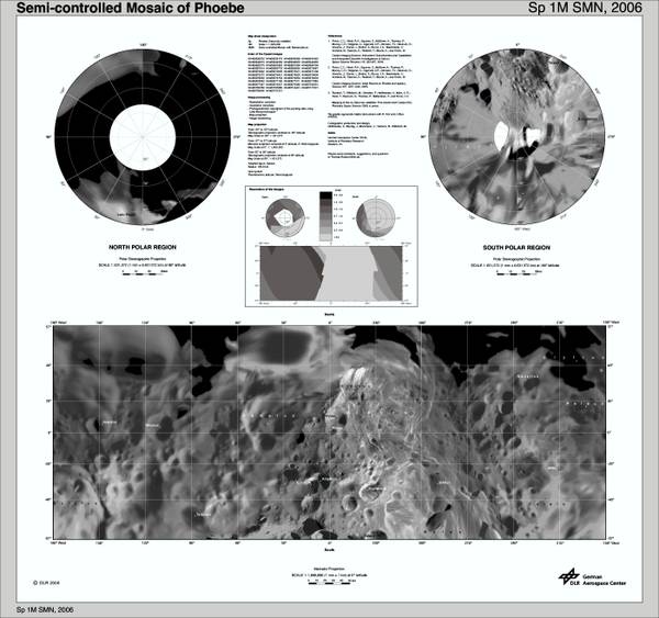
The mosaic is projected into the Mercator projection within the latitude range of 57 degrees south to 57 degrees north latitude; the stereographic projections represent latitudes greater/lower than ±55 degrees. (Thus, this map meets the standard scale of 1:1,000,000 recommended by the USGS [Kirk 1997, 2002, 2003].)
Here you can see a three dimentional version of Phoebe. You can scroll by dragging Phoebe and zoom in and zoom out by using your mouse wheel. This page only works well with WebGL compatible browsers like Firefox4 and Chrome. You also need a good graphic card.
References:
Roatsch, T., Wählisch M., Scholten, F., Hoffmeister, A., Matz K.-D., Denk, T., Neukum G. Thomas, P., Helfenstein, P., and Porco, C.C., 2006:
Mapping of the icy Saturnian satellites: First results from Cassini-ISS. Planetary and Space Sciences 54, 1137-1145.
Last update: 06/06/2011 19:36